TriniTuner.com | Latest Event:


Moderator: 3ne2nr Mods

Bulletin #
Date: Thursday 10th of November 2016
ISSUED AT: 03:29 PM
INCLEMENT WEATHER TO AFFECT TRINIDAD AND TOBAGO
Trinidad and Tobago will continue to experience
cloudy to overcast conditions with showers and
thundershowers. This activity is related to the
presence of a trough system and the Inter-Tropical
Convergence Zone (ITCZ).
Numerical Weather Prediction Models (NWP) forecast
that there is a 60% chance that this rainfall
activity will intensify near late evening into
tonight and continue intermittently for at least 6
- 12 hours. Although rainfall activity is not
expected to be widespread, the occurrence of heavy
showers in localized areas can yield rainfall
accumulations between 25 to 30 mm or even greater
in some locations.
It should be noted that gusty winds and localized
street/flash flooding may occur in the vicinity of
heavy showers and thundershowers. The possibility
of landslides/landslips also exists. Be alert to
any electrical discharges from thundercloud
activity.
Citizens are advised to be vigilant and cautious
as they conduct their daily activities given the
forecast weather conditions. All necessary
measures must be adopted to preserve life and
property. WE STRONGLY UNDERSCORE THAT TRINIDAD
AND TOBAGO IS NOT UNDER ANY TROPICAL STORM THREAT,
WATCH OR WARNING. The Trinidad and Tobago
Meteorological Service is closely monitoring
weather conditions and will issue another bulletin
if the situation warrants.
Shakeer Baig
Meteorologist

computercentral wrote:Hot sun tonight then


Bulletin #
Date: Thursday 24th of November 2016
ISSUED AT: 09:14 AM
INCLEMENT WEATHER TO AFFECT TRINIDAD AND TOBAGO
Trinidad and Tobago will continue to experience
cloudy to overcast conditions with showers and
thundershowers. This activity is related to the
presence of the Inter-Tropical Convergence Zone
(ITCZ).
Numerical Weather Prediction Models (NWP) forecast
that there is a 60% chance that this rainfall
activity will intensify later today and continue
intermittently for at least 12 - 18 hours.
Although rainfall activity is not expected to be
widespread, the occurrence of heavy showers in
localized areas can yield rainfall accumulations
between 25 to 30 mm or even greater in some
locations.
It should be noted that gusty winds and localized
street/flash flooding may occur in the vicinity of
heavy showers and thundershowers. The possibility
of landslides/landslips also exists. Be alert to
any electrical discharges from thundercloud
activity. Citizens are advised to be vigilant
and cautious as they conduct their daily
activities given the forecast weather conditions.
All necessary measures must be adopted to preserve
life and property.
WE STRONGLY UNDERSCORE THAT TRINIDAD AND TOBAGO IS
NOT UNDER ANY TROPICAL STORM THREAT, WATCH OR
WARNING. The Trinidad and Tobago Meteorological
Service is closely monitoring weather conditions
and will issue another bulletin if the situation
warrants.
Shakeer Baig
Meteorologist


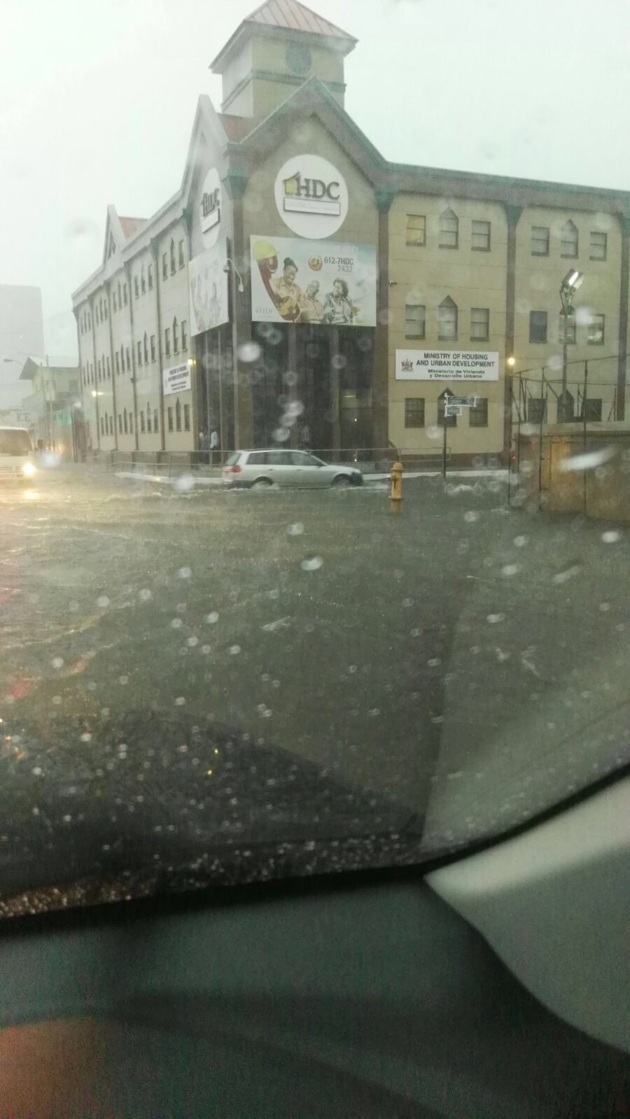
shake d livin wake d dead wrote:I could see p.o.s flooding today


pugboy wrote:Hopefully tide low so water will run off fast

Return to “Ole talk and more Ole talk”
Users browsing this forum: Google [Bot], Strugglerzinc and 101 guests