TriniTuner.com  |  Latest Event:  

Forums

The official WAZE GPS navigation thread

this is how we do it.......

Moderator: 3ne2nr Mods

SRASC
3NE 2NR Moderator
Posts: 3256
Joined: January 13th, 2008, 10:53 am

Re: Google MapMaker/OpenStreetMaps | Mapping Trinidad & Toba

Postby SRASC » May 13th, 2011, 10:11 am

kes_vtec wrote:openstreet looking very good....
so guys what are we going to do...

can we do both..., if you make a edit in google do it on openstreet...


That's what I would like to know. Thing is Google MapMaker have more building & road names in its database whereas OpenStreetMaps has a better road layout. Combining the 2 would really help.

M_2NR
not Admin
Posts: 7247
Joined: December 18th, 2008, 9:46 pm

Re: Google MapMaker/OpenStreetMaps | Mapping Trinidad & Toba

Postby M_2NR » May 13th, 2011, 11:14 am

http://code.google.com/p/teryt2osm/
quick google loaded this
i guess ill check it out more later on in the day... gotta fix up for jumma.
I loving all this enthusiasm.

ohh shhhhhh i forgot about licenses etc.... basically it wont be ethical copying from google...
Why don't you just use Google Maps/whoever for your data?

Short answer:

Because that data is copyrighted and owned by people like the Ordnance Survey. Google/whoever just license it. If we used it, we'd have to pay for it.

Long answer:

Most hackers around the world are familiar with the difference between "free" as in "free beer" and as in "free speech". Google Maps are free as in beer, not as in speech.

If your project's mapping needs can be served simply by using the Google Maps API, all to the good. But that's not true of every project. We need a free dataset which will enable programmers, social activists, cartographers and the like to fulfil their plans without being limited either by Google's API or by their Terms of Service.

At this point, the usual rejoinder is "Why don't you just get people to click a point on a Google map, then record the latitude and longitude in the Openstreetmap database? That's free, isn't it?"

Unfortunately not. The data used in Google Maps is either owned by Google itself, or sourced from NAVTEQ and Tele Atlas, two big mapping companies. They, in turn, have obtained some of this data from national mapping agencies (such as the Ordnance Survey). Since they've made multi-million pound investments in gathering this data, all these organisations are understandably protective of their copyright.

If you collect data from Google Maps in this way, you are creating a "derived work". Any such data retains the copyright conditions of the original. In practice, this means your data is subject to the licensing fees, and contractual restrictions, of these map providers. That's exactly what Openstreetmap is trying to avoid.

Please don't be misled by considerations of software copyright, or of Terms of Use. The Google Maps API can be incorporated into open source projects, sure. But this only governs how you use the software - it doesn't have any implications whatsoever for the data displayed by this API, which is still under copyright.

(It's not yet clear whether it's ok to create a derived work from aerial photography: some readings of UK law suggest that you can do this without 'inheriting' the copyright in the photography. A definitive ruling on this could open up new avenues for Openstreetmap and similar projects, but in the absence of such a ruling, we're continuing with the approach of sourcing our own, 100% independent data.)

[source]

:x :x :x

User avatar
mojosodope
I LUV THIS PLACE
Posts: 940
Joined: April 14th, 2011, 5:27 pm

Re: Google MapMaker/OpenStreetMaps | Mapping Trinidad & Toba

Postby mojosodope » May 13th, 2011, 11:55 am

why is it that in map maker the hybrid maps are perfectly aligned but if you view it on google maps they are off?

zcrugby
3NE 2NR for life
Posts: 126
Joined: June 26th, 2008, 9:40 am
Location: Glenco

Re: Google MapMaker/OpenStreetMaps | Mapping Trinidad & Toba

Postby zcrugby » May 14th, 2011, 4:00 am

M_2NR wrote:City maps 2go:
http://itunes.apple.com/us/app/city-map ... 83342?mt=8

works on iphone and pulls from openmaps

but thing is can openmaps pull from google? because all the geodata and streets etc there already... why waste time plotting when we could just edit and shift the tile around no?

not sure if thats possible.. if u find out let us know.

zcrugby
3NE 2NR for life
Posts: 126
Joined: June 26th, 2008, 9:40 am
Location: Glenco

Re: Google Maps *HELPING T&T OUT*

Postby zcrugby » May 14th, 2011, 4:01 am

Tired Accord wrote:
zcrugby wrote:
zcarz wrote:can those maps (from mapmaker) be used on mobile devices (eg iphone, android)

earlier in this thread i updated iphone compatible maps of trinidad. will be out of date now tho. i lost the progrom i used to download them :( but its very useable, just have to download xgps from cydia and xgps manager to your computer to transfer the maps.


Hold on hold on....zcrugby Are you saying that with these xgps applications, one can download and export maps to say....a jailbroken iPad 3G, and be used without a wireless data connection? :roll: :roll:

yes thats wat im sayin. trinidads map in the format for xgps is already on this thread.

zcrugby
3NE 2NR for life
Posts: 126
Joined: June 26th, 2008, 9:40 am
Location: Glenco

Re: Google MapMaker/OpenStreetMaps | Mapping Trinidad & Toba

Postby zcrugby » May 14th, 2011, 4:02 am

kes_vtec wrote:openstreet looking very good....
so guys what are we going to do...

can we do both..., if you make a edit in google do it on openstreet...

possible but might be time consuming? and id say google maps is pretty much good now.. openstreet needs the more attention

zcrugby
3NE 2NR for life
Posts: 126
Joined: June 26th, 2008, 9:40 am
Location: Glenco

Re: Google MapMaker/OpenStreetMaps | Mapping Trinidad & Toba

Postby zcrugby » May 14th, 2011, 4:04 am

mojosodope wrote:why is it that in map maker the hybrid maps are perfectly aligned but if you view it on google maps they are off?

thats what this thread is about.. we are tryin to get google to use the mapmaker images instead of the one they use now. its there fault and only they can fix it.

zcrugby
3NE 2NR for life
Posts: 126
Joined: June 26th, 2008, 9:40 am
Location: Glenco

Re: Google MapMaker/OpenStreetMaps | Mapping Trinidad & Toba

Postby zcrugby » May 14th, 2011, 4:08 am

SUPAstarr wrote:an anybody explain how i can download the map an data to use offline?

depends on wat map u want to download (from where) and wat device u want to use it on.

User avatar
janfar
punchin NOS
Posts: 3367
Joined: August 13th, 2004, 1:39 am
Location: studying pigonometry...

Re: Google MapMaker/OpenStreetMaps | Mapping Trinidad & Toba

Postby janfar » May 18th, 2011, 8:16 am

guys... was going thru my area in Mayaro and noticed a few things were inaccurate and were still approved e.g. From the Mayaro junction (which is out of place) has the road going all the way to south of Trinidad and is named Manzanilla Mayaro Road, this is in fact the Guayaguayare Mayaro road and should be changed. How can I go about getting this changed.

M_2NR
not Admin
Posts: 7247
Joined: December 18th, 2008, 9:46 pm

Re: Google MapMaker/OpenStreetMaps | Mapping Trinidad & Toba

Postby M_2NR » May 19th, 2011, 10:42 am

^google mapmaker?
If yes, create a google account or sign in with your gmail and edit it ;)

___

I just updated Motion-X GPS app on iPhone and normally I'd use bing maps but i say let me try their openmaps which pulls from OpenStreetMaps. Lo and behold im seeing A LOT! of road data now. I could say at least 10 times more than what used to be there. Good job whoever is doing it. I wont mind joining in.

Z, Check my latest post above... I think it has legal issues doing so as in pulling from Google data.

SRASC
3NE 2NR Moderator
Posts: 3256
Joined: January 13th, 2008, 10:53 am

Re: Google MapMaker/OpenStreetMaps | Mapping Trinidad & Toba

Postby SRASC » May 19th, 2011, 11:16 am


lostallos101
Riding on 18's
Posts: 1606
Joined: October 16th, 2010, 8:28 pm
Location: inna de car back..........

Re: Google MapMaker/OpenStreetMaps | Mapping Trinidad & Toba

Postby lostallos101 » May 19th, 2011, 11:45 am

does mnav have a gps map of TnT...why not use that to update google own....is that possible?

SRASC
3NE 2NR Moderator
Posts: 3256
Joined: January 13th, 2008, 10:53 am

Re: Google MapMaker/OpenStreetMaps | Mapping Trinidad & Toba

Postby SRASC » May 19th, 2011, 12:19 pm

I think that particular topic was discussed before, but I doubt they would as this page would show.

zcrugby
3NE 2NR for life
Posts: 126
Joined: June 26th, 2008, 9:40 am
Location: Glenco

Re: Google MapMaker/OpenStreetMaps | Mapping Trinidad & Toba

Postby zcrugby » May 19th, 2011, 2:16 pm

lostallos101 wrote:does mnav have a gps map of TnT...why not use that to update google own....is that possible?

Because you have to pay for mnav

Kenjo
punchin NOS
Posts: 3580
Joined: March 19th, 2009, 10:31 pm
Location: Home

Re: Google Maps *HELPING T&T OUT*

Postby Kenjo » May 26th, 2011, 5:14 pm

Kenjo wrote:has anyone ever tried http://www.openstreetmap.org" target="_blank editing to add Trini roads?it is a linux based free mapping system with free downloads with voice navigation?
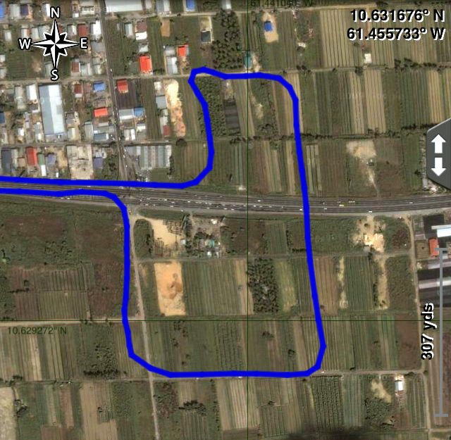
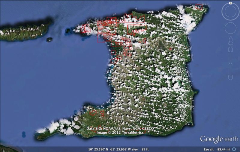
i am so happy to see guys adopting openstreetmaps because the road images have improved so much from when i first added it.The program i use Navit allows great turn by turn directions that got me out of a bind down south today that avoided me having to stop to ask for directions.keep up the good work!

User avatar
janfar
punchin NOS
Posts: 3367
Joined: August 13th, 2004, 1:39 am
Location: studying pigonometry...

Re: Google MapMaker/OpenStreetMaps | Mapping Trinidad & Toba

Postby janfar » May 27th, 2011, 7:37 am

SRASC... I got it done with no problems... now i face another dilema... someone in all the Godly attributes just made a big circle around Mayaro and named it Pierreville and now I cannot do some other stuff in my area (Mafeking) since most of it is wrongly labeled. I made the edit already but no one has approved it yet... waiting on that approval... anyone willing to assist???

SRASC
3NE 2NR Moderator
Posts: 3256
Joined: January 13th, 2008, 10:53 am

Re: Google MapMaker/OpenStreetMaps | Mapping Trinidad & Toba

Postby SRASC » May 31st, 2011, 4:49 pm

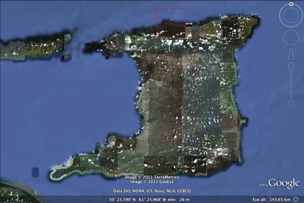
Well we got another update.

Image

Too bad its another one of these...

Haven't been able to check it out as often as I have in the past. Being a little swamped with work as of late.

SRASC
3NE 2NR Moderator
Posts: 3256
Joined: January 13th, 2008, 10:53 am

Re: Google MapMaker/OpenStreetMaps | Mapping Trinidad & Toba

Postby SRASC » June 29th, 2011, 6:48 pm

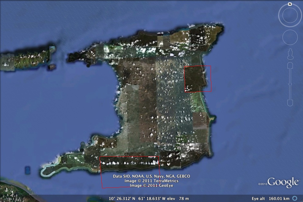
Another month, another update

Image

SRASC
3NE 2NR Moderator
Posts: 3256
Joined: January 13th, 2008, 10:53 am

Re: Google MapMaker/OpenStreetMaps | Mapping Trinidad & Toba

Postby SRASC » January 3rd, 2012, 11:19 am

MapMaker like many of Google's services as of late has gotten an update. One thing concerns me though, someone has been deleting features/places that as far as I know still exist like the Neal & Massey compound...

SRASC
3NE 2NR Moderator
Posts: 3256
Joined: January 13th, 2008, 10:53 am

Re:

Postby SRASC » January 3rd, 2012, 12:22 pm

zcrugby wrote:OMG even has sum directions.. although i must say who ever made the directions went up the road by the stadium for no reason.. lol
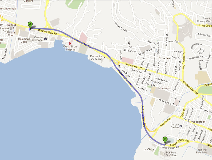
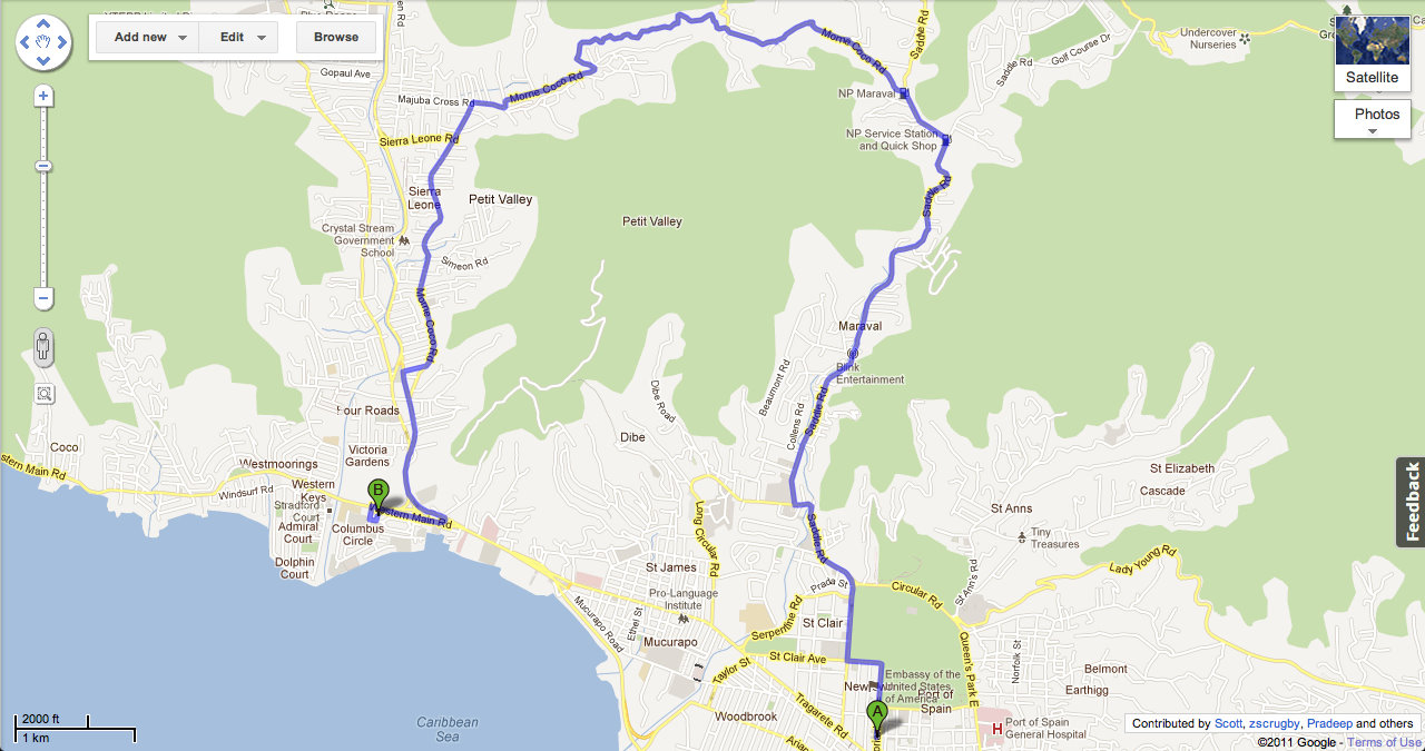
Image


Image

At least the directions have improved... sorta

then again...

Image
From: McDonald's (Cipriani Blvd)
To: KFC (Westmoorings)

SRASC
3NE 2NR Moderator
Posts: 3256
Joined: January 13th, 2008, 10:53 am

Re: Google MapMaker/OpenStreetMaps | Mapping Trinidad & Toba

Postby SRASC » January 11th, 2012, 7:39 pm

Can anyone verify the removal of many points? Checking what's up for review & see that many are up for deletion, I don't think that they are closed.

SRASC
3NE 2NR Moderator
Posts: 3256
Joined: January 13th, 2008, 10:53 am

Google MapMaker/OpenStreetMaps | Mapping Trinidad & Tobago

Postby SRASC » January 17th, 2012, 5:59 pm

Now going to check and see
Attachments
ImageUploadedByTapatalk1326837557.335378.jpg

SRASC
3NE 2NR Moderator
Posts: 3256
Joined: January 13th, 2008, 10:53 am

Re: Google MapMaker/OpenStreetMaps | Mapping Trinidad & Toba

Postby SRASC » January 18th, 2012, 4:25 pm

What I think they did was put back the old not-as-cloud-filled imagery & called it an 'update'.

M_2NR
not Admin
Posts: 7247
Joined: December 18th, 2008, 9:46 pm

Re: Google MapMaker/OpenStreetMaps | Mapping Trinidad & Toba

Postby M_2NR » January 19th, 2012, 11:01 am

yup. 2006 imagery.

redmanjp
TriniTuner 24-7
Posts: 16261
Joined: September 22nd, 2009, 11:01 pm
Contact:

Re: Google MapMaker/OpenStreetMaps | Mapping Trinidad & Toba

Postby redmanjp » January 19th, 2012, 12:15 pm

so the maps still have the points whereas the satellite image doesn't?

SRASC
3NE 2NR Moderator
Posts: 3256
Joined: January 13th, 2008, 10:53 am

Google MapMaker/OpenStreetMaps | Mapping Trinidad & Tobago

Postby SRASC » January 20th, 2012, 4:22 pm

Good news: At least now I could map out some other places where the clouds were blocking before.

Bad news: Instead of the imagery being 5 years old (as of 2012) it's now 6 years old.

To those that are mapping places don't forget map it out as a building or boundary rather than just a point on the map. Google Reviewers request this anyway so it's a timesaver to just do it as such one time.

SRASC
3NE 2NR Moderator
Posts: 3256
Joined: January 13th, 2008, 10:53 am

Re: Google MapMaker/OpenStreetMaps | Mapping Trinidad & Toba

Postby SRASC » January 22nd, 2012, 2:10 pm

Image

Lot has happened in 6 years Google...

redmanjp
TriniTuner 24-7
Posts: 16261
Joined: September 22nd, 2009, 11:01 pm
Contact:

Re: Google MapMaker/OpenStreetMaps | Mapping Trinidad & Toba

Postby redmanjp » January 22nd, 2012, 10:22 pm

guess we go have to wait til d satellite pass over we & take pic

SRASC
3NE 2NR Moderator
Posts: 3256
Joined: January 13th, 2008, 10:53 am

Re: Google MapMaker/OpenStreetMaps | Mapping Trinidad & Toba

Postby SRASC » February 1st, 2012, 10:39 am

Google Earth February 2012 Imagery Update (Trinidad & Tobago)

Image

User avatar
nemisis
punchin NOS
Posts: 4354
Joined: February 26th, 2010, 10:09 am

Re: Google MapMaker/OpenStreetMaps | Mapping Trinidad & Toba

Postby nemisis » March 13th, 2012, 10:35 am

looking for a point fortin from san fernando map any idiot can follow, seems google map too confusing for some

Advertisement

Return to “Ole talk and more Ole talk”

Who is online

Users browsing this forum: No registered users and 198 guests