TriniTuner.com | Latest Event:


Moderator: 3ne2nr Mods
kes_vtec wrote:openstreet looking very good....
so guys what are we going to do...
can we do both..., if you make a edit in google do it on openstreet...
Why don't you just use Google Maps/whoever for your data?
Short answer:
Because that data is copyrighted and owned by people like the Ordnance Survey. Google/whoever just license it. If we used it, we'd have to pay for it.
Long answer:
Most hackers around the world are familiar with the difference between "free" as in "free beer" and as in "free speech". Google Maps are free as in beer, not as in speech.
If your project's mapping needs can be served simply by using the Google Maps API, all to the good. But that's not true of every project. We need a free dataset which will enable programmers, social activists, cartographers and the like to fulfil their plans without being limited either by Google's API or by their Terms of Service.
At this point, the usual rejoinder is "Why don't you just get people to click a point on a Google map, then record the latitude and longitude in the Openstreetmap database? That's free, isn't it?"
Unfortunately not. The data used in Google Maps is either owned by Google itself, or sourced from NAVTEQ and Tele Atlas, two big mapping companies. They, in turn, have obtained some of this data from national mapping agencies (such as the Ordnance Survey). Since they've made multi-million pound investments in gathering this data, all these organisations are understandably protective of their copyright.
If you collect data from Google Maps in this way, you are creating a "derived work". Any such data retains the copyright conditions of the original. In practice, this means your data is subject to the licensing fees, and contractual restrictions, of these map providers. That's exactly what Openstreetmap is trying to avoid.
Please don't be misled by considerations of software copyright, or of Terms of Use. The Google Maps API can be incorporated into open source projects, sure. But this only governs how you use the software - it doesn't have any implications whatsoever for the data displayed by this API, which is still under copyright.
(It's not yet clear whether it's ok to create a derived work from aerial photography: some readings of UK law suggest that you can do this without 'inheriting' the copyright in the photography. A definitive ruling on this could open up new avenues for Openstreetmap and similar projects, but in the absence of such a ruling, we're continuing with the approach of sourcing our own, 100% independent data.)

M_2NR wrote:City maps 2go:
http://itunes.apple.com/us/app/city-map ... 83342?mt=8
works on iphone and pulls from openmaps
but thing is can openmaps pull from google? because all the geodata and streets etc there already... why waste time plotting when we could just edit and shift the tile around no?
Tired Accord wrote:zcrugby wrote:zcarz wrote:can those maps (from mapmaker) be used on mobile devices (eg iphone, android)
earlier in this thread i updated iphone compatible maps of trinidad. will be out of date now tho. i lost the progrom i used to download thembut its very useable, just have to download xgps from cydia and xgps manager to your computer to transfer the maps.
Hold on hold on....zcrugby Are you saying that with these xgps applications, one can download and export maps to say....a jailbroken iPad 3G, and be used without a wireless data connection?
kes_vtec wrote:openstreet looking very good....
so guys what are we going to do...
can we do both..., if you make a edit in google do it on openstreet...
mojosodope wrote:why is it that in map maker the hybrid maps are perfectly aligned but if you view it on google maps they are off?
SUPAstarr wrote:an anybody explain how i can download the map an data to use offline?
lostallos101 wrote:does mnav have a gps map of TnT...why not use that to update google own....is that possible?
Kenjo wrote:has anyone ever tried http://www.openstreetmap.org" target="_blank editing to add Trini roads?it is a linux based free mapping system with free downloads with voice navigation?
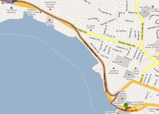
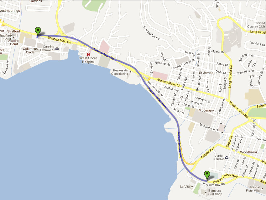
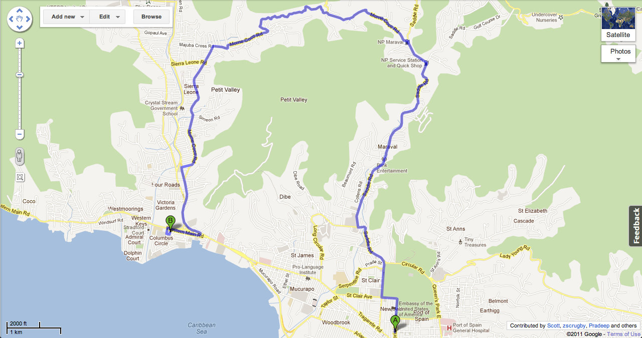
zcrugby wrote:OMG even has sum directions.. although i must say who ever made the directions went up the road by the stadium for no reason.. lol
Return to “Ole talk and more Ole talk”
Users browsing this forum: Google [Bot] and 147 guests