Moderator: 3ne2nr Mods
bluefete wrote:ST Auto wrote:^^ and where is that info coming from?
Go and read it for yourself!!!!
http://www.nhc.noaa.gov/gtwo.php?basin=atlc&fdays=2
bluefete wrote:PariaMan wrote:Thing done pass us already. Another false alarm
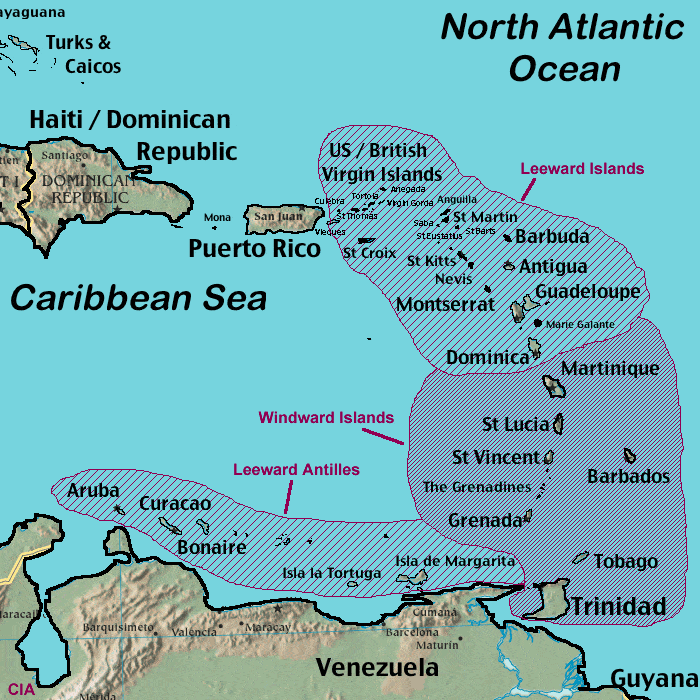
You are a special kind of special or you simply do not know geography.
tony125 wrote:"Interests in the Windward and southern Leeward Islands, Bonaire, Curacao, Aruba, and along the northern coast of South America should monitor the progress of this disturbance"
Correct me if I'm wrong but T&T is located along the north coast of South America.
PariaMan wrote:
That already north of us! Judge for yourself!


T&T are part of the Windward Islands of the West IndiesPariaMan wrote:We are not Windward Islands

Duane 3NE 2NR wrote:
ZCZC MIATWOAT ALL
TTAA00 KNHC DDHHMM
SPECIAL TROPICAL WEATHER OUTLOOK
NWS NATIONAL HURRICANE CENTER MIAMI FL
420 PM EDT TUE SEP 27 2016
Regardless of
whether the system is a tropical wave or tropical cyclone, heavy
rains and tropical-storm-force winds in squalls are expected to
spread over the Windward Islands and portions of the southern
Leeward Islands, beginning tonight and continuing through
Wednesday.
* Formation chance through 48 hours...high...90 percent
* Formation chance through 5 days...high...90 percent

isn't that what MET Office said anyway?wx_klb wrote: Worst we'll see is some rain, gusty winds and probably some flooding
Mercenary wrote:Cud reli use the rain. :/
shake d livin wake d dead wrote:Steupse....I real looking forward to some bad weather.
PariaMan wrote:More like complaining about bad information. When there is a real threat people will not take it serious. Just watch the latest satellite so obviously heading north and people still saying lookout for rain.
Return to “Ole talk and more Ole talk”
Users browsing this forum: pugboy and 14 guests